Austin or Bust: A Post-Y'allhands Adventure
Published 2020-11-01
Due to a variety of factors, Mozilla changed venues for our 2017 winter all-hands meeting to Austin, Texas, and Austin being a city with relatively poor commercial airline connectivity, ticket prices were fairly high even for me to fly there from Phoenix. High enough, actually, that I'd already flown myself to Austin earlier that year for a graduation — two round-trip economy tickets cost more than the aviation fuel it'd take to fly ourselves. The same general logic held for the Mozilla trip, but there was only one of me. But if I brought two colleagues back with me and they could get much cheaper airfare out of Phoenix Sky Harbor... well, a spreadsheet proved the math, but we all know the real idea here.
It gave us the Great Post Ya'll-Hands Adventure!
But getting ahead of myself just a little - weather between Arizona and eastern Texas in December tends to be reasonably predictable: there's unpredictable fog there in coastal Texas, but generally bad weather comes as fronts. As long as you can be flexible on your trip dates if there's going to be a frontal passage soon, it's not a bad time of year to take to the skies in the southern US.
I set myself up so that I had options to arrive in Austin up to several days in advance of the week of meetings, had side-trips available for the return, leeway before the international flights home for my colleagues, and the definite option to leave the conference early should we need to. It looked good, so I proceeded to confuse the hell out of the travel folks for the two months before the conference.
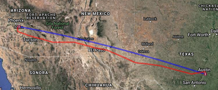
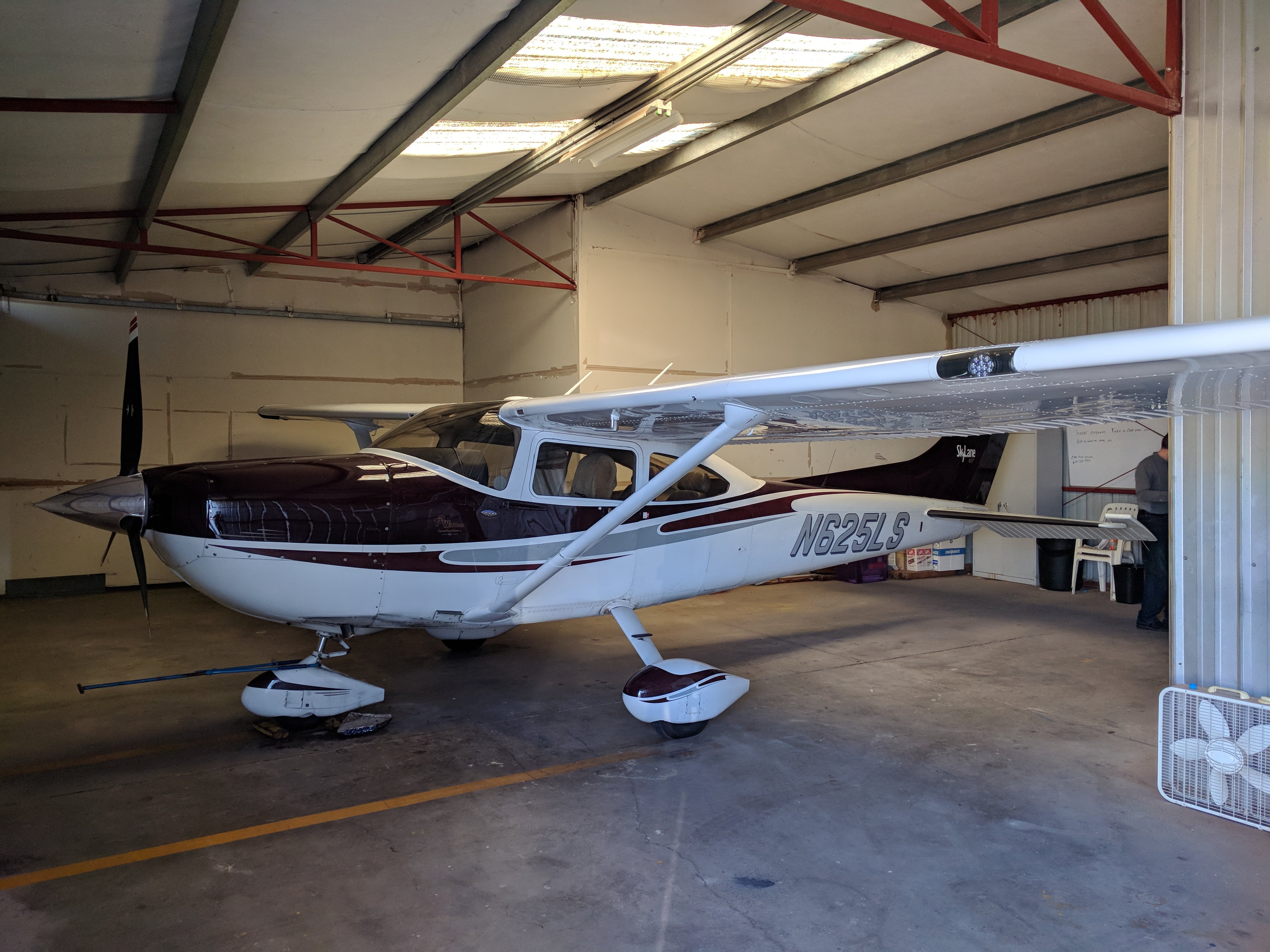
Watching the weather closely the week ahead of the event, the route out looked like it was going to be smooth sailing on the official arrival day, so I didn't take off early. I planned for an 8:30am departure out of KCHD. When I flew to Austin earlier that year, I landed at Austin Executive. This time, since Mozilla was meeting at Austin International, I checked prices and found them to be a wash for a Cessna 182, so I filed IFR to KAUS.
Fully loaded with 88 gallons of fuel - about 8 hours of cruising time - I had plenty of range to make it the 780 nautical miles with IFR reserves to spare.
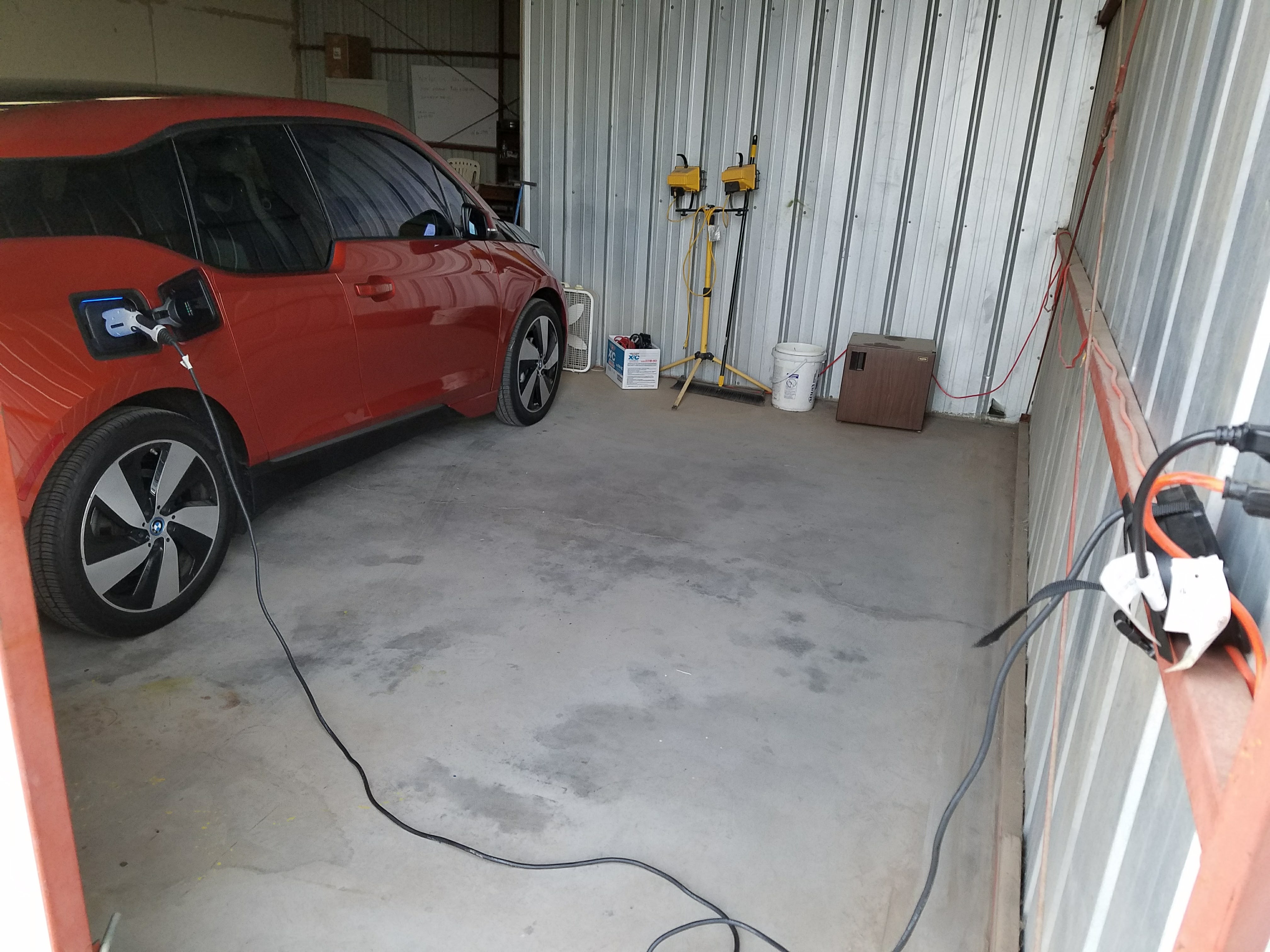
At this time I had a cute battery-electric car which I could pull into the hangar and plug in so it'd be fully charged for the return home.
Chandler Tower had me waiting almost 20 minutes for an IFR release that morning; plenty of time to plug in the full IFR clearance, check Twitter, you know. But the engine was running, and just as I was getting ready to take off VFR and activate en-route, Tower called, something like, "N625LS, I have your IFR release, line up and wait runway 4L."
Of course, there was a taildragger that had pulled in front of me. "Unable, I have an aircraft ahead of me on the taxiway."

Then the tower controller had fun trying to raise the other plane, which hadn't yet switched to the tower's radio frequency, to get them out of the way. Phoenix Departure was presumably holding airspace open for me, so they wanted me in the air ASAP, which hey, suited me after that wait. Chandler isn't known to be busy enough to clear multiple aircraft in one instruction, but here it was in one breath something like, "(taildragger) cleared for takeoff runway 4 left no delay Cessna 625LS line up and wait runway 4 left no delay!"
Yes, sir. Of course, all that and Phoenix Departure has me fly 20 miles straight South (a bit out of the way) before letting me turn on-course, but it was smooth sailing the rest of the way.
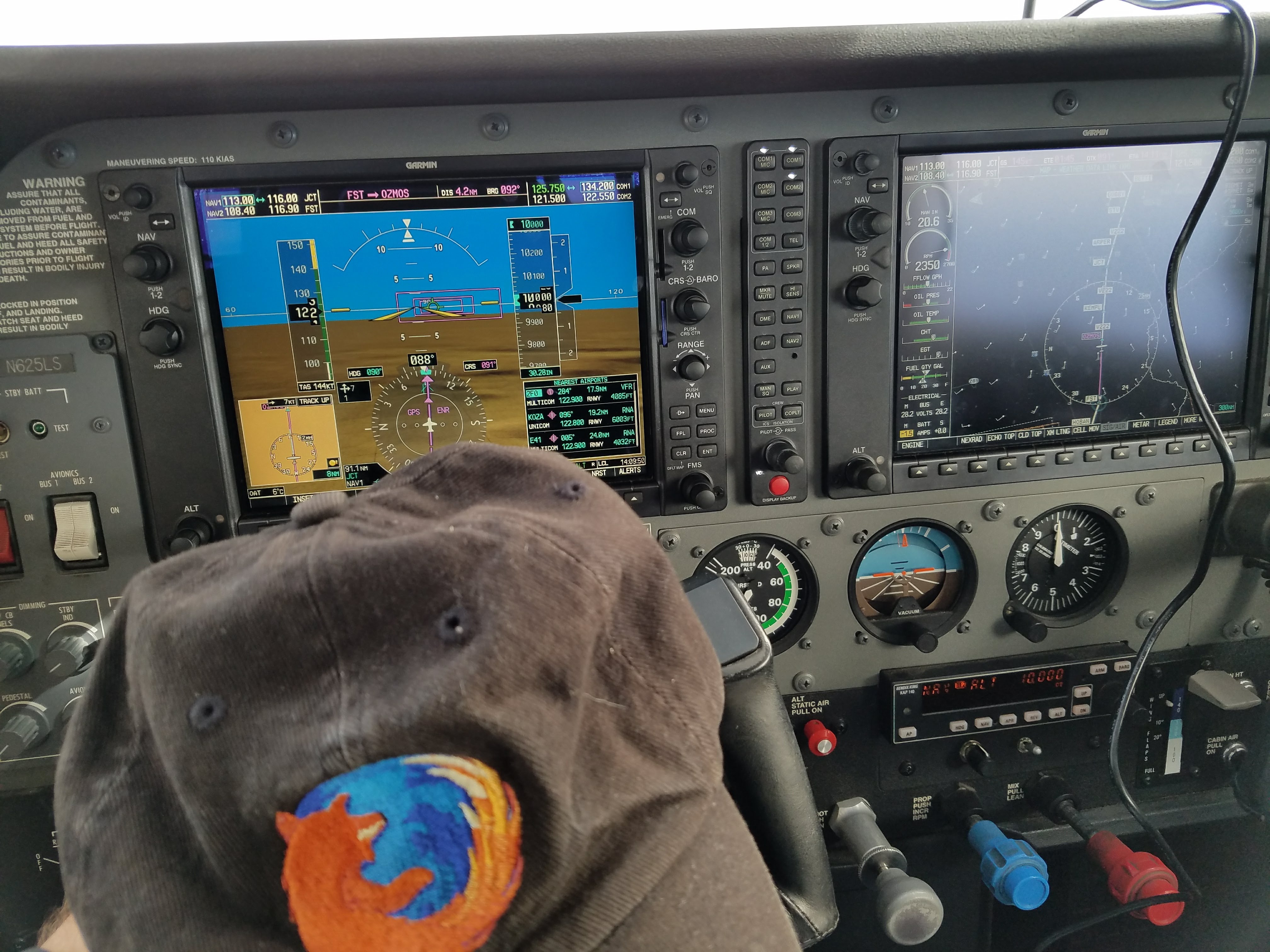
The flight was about 5 hours and 45 minutes, though the delay at the front made the time to be 6.1 hours in my logbook. I took a few photos, but nothing much remarkable. Mostly I tuned to an XM satellite radio station while I listened to long stretches of radio silence, watched the engine instruments, and kept tabs of the "Nearest Airports" list.
The Austin area had high clouds but unlimited visibility, and I arrived with the computer showing over two hours remaining fuel endurance left, plus another 45 minute IFR reserve.

Austin Approach asked me two times to confirm I was landing at Austin International and not Austin Executive, and then asked in advance where I was parking - that's a little odd for the approach controller to care about parking details, but I guess I was enough of a curiosity that they checked carefully.
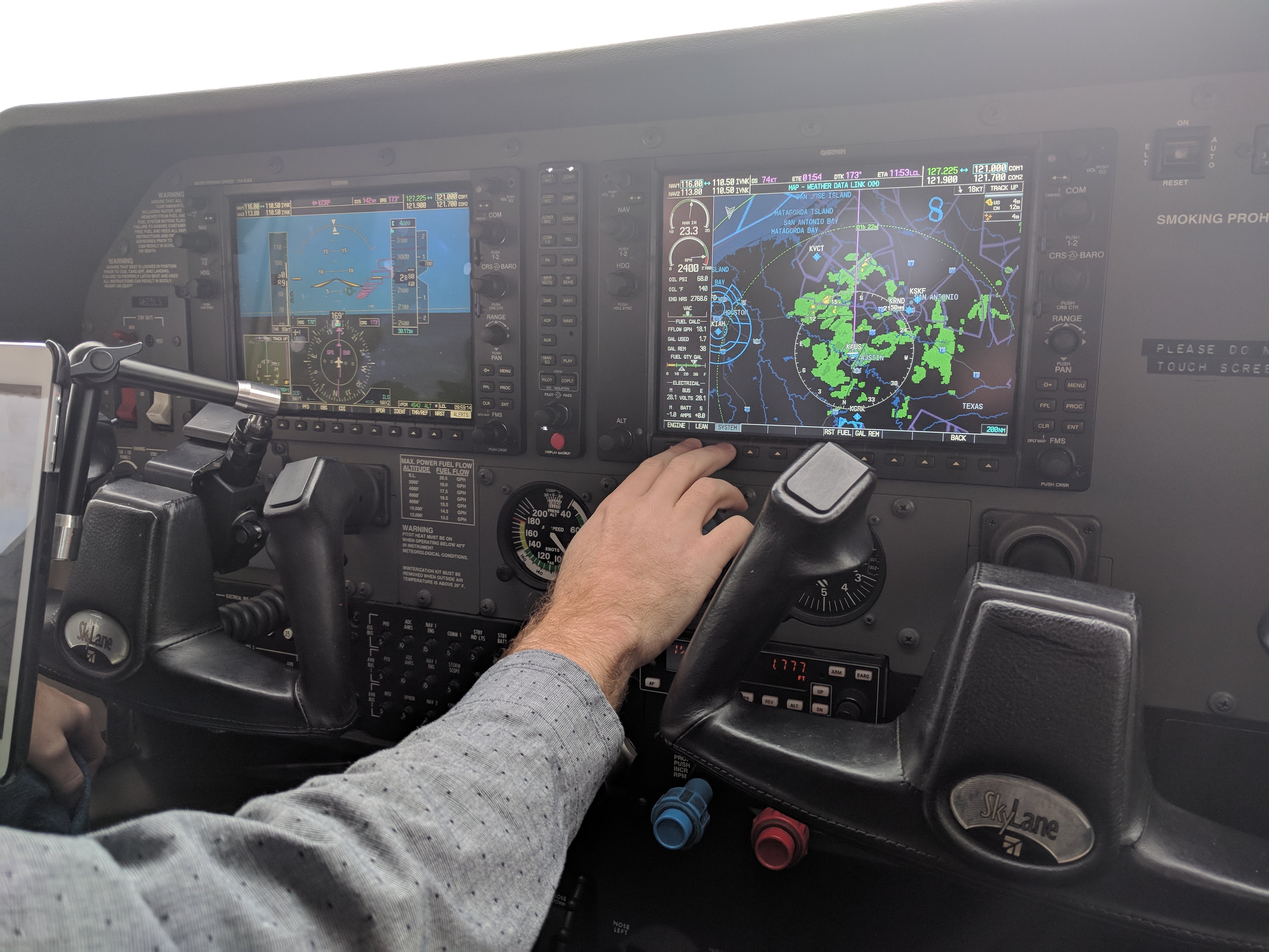
Even though the day was totally clear, Approach gave me radar vectors to the SCALI intersection for runway 17 Left before letting me turn inbound on the final approach course. It was pretty clear what was happening, as I'd studied all the approaches, so I plugged in the localizer and the ILS procedure into the navigation system and flew the 6 mile final approach via RRTOO and DDTOO.
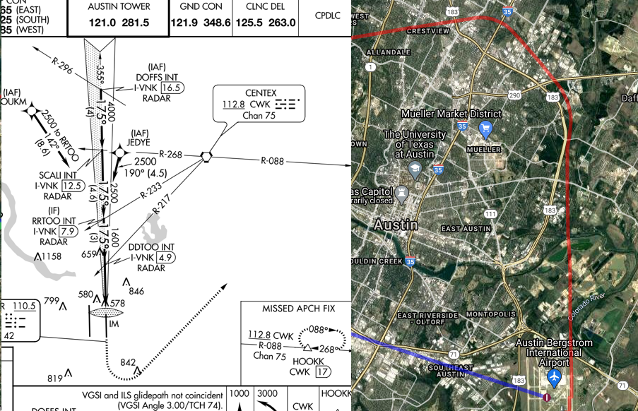
I'm honestly not sure why I was given such a wide path that day; there was other inbound airliner traffic that was sequenced behind me, and I never heard anyone ahead of me. Anyway, there was a reason, and it was an easy approach - since it was an ILS path anyway, some of it I let the autopilot fly.
As Approach had asked where I was parking in advance, Austin Tower and Ground already knew, and the ground controller gave me a hearty "Welcome to Texas!" followed by progressive taxi instructions without me even having to ask, which I greatly appreciated.
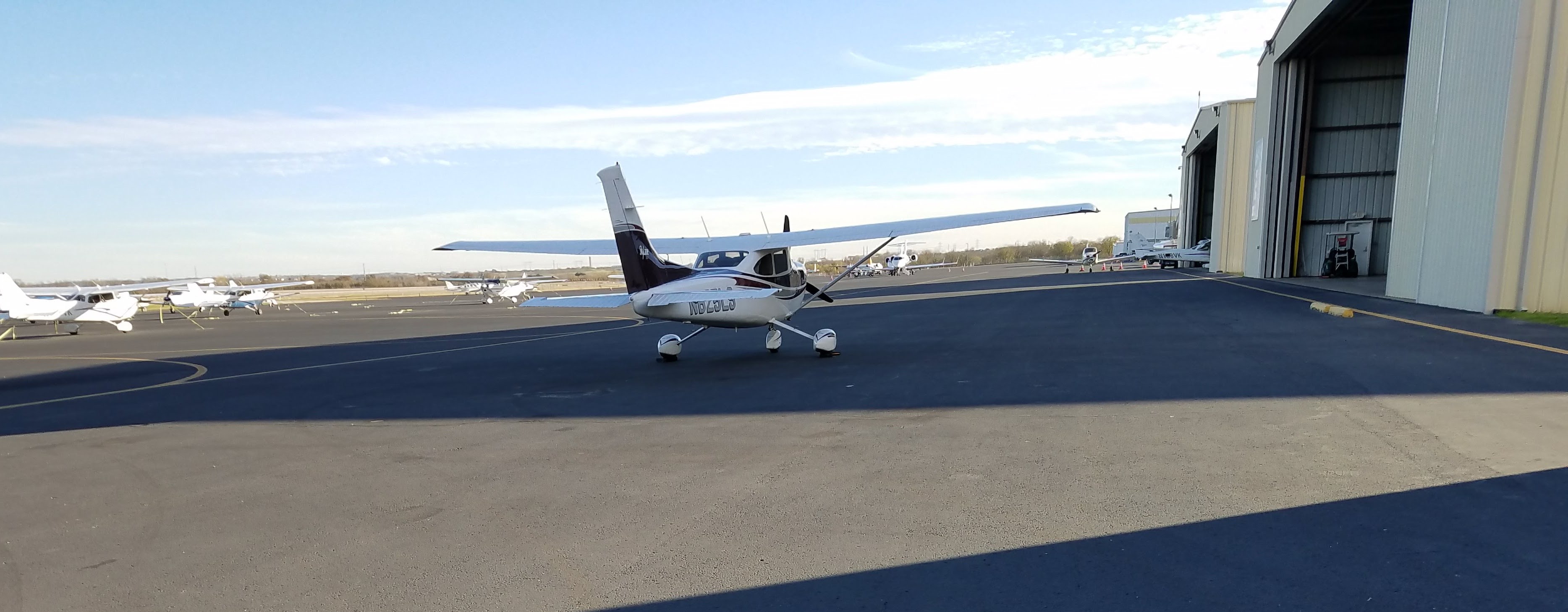
The FBO's "follow me" cart had me park kind of in the middle of nowhere, but they gave me a ride back to their building so hey, no problem. I left the aircraft in their hands with a request for a couple dozen gallons of fuel to be added; I was playing the game of "enough fuel for them to waive fees" but not "pay their inflated prices for the whole tank."
The work week went by quite quickly. There's even a recording of my lightning talk about Web Authentication for people who want a break from all this fun aviation stuff. I kept a close eye on the weather, as it wasn't going to be as easy a trip home as it was to come out.
My return-trip passengers and I had several check-in points about whether we'd need to leave early on Friday, or stay through the end of the work week and depart Saturday, but it ultimately looked like Friday wouldn't help us, we really needed to wait until Sunday to cross Texas again.
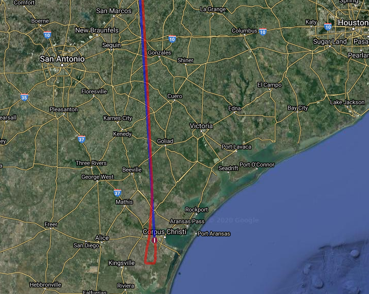
I had a contingency planned. Saturday morning came with the promise of bad weather from a cold front moving across Texas, but while it was raining already, the bad stuff hadn't arrived yet. Still, we were definitely going to wait it out — but we didn't have to wait it out in Austin! I had family 150 miles south in Corpus Christi, Texas, on the coast of the Gulf of Mexico, and they were happy to spend their Saturday with us.
The weather was coming though, and Corpus was varying back and forth between instrument conditions with fog and marginal visibility. The forecast had more than 5 hours before Austin or San Antonio were going to have real weather issues, though, so we had a variety of options if we couldn't make it into Corpus Christi. I filed an IFR flight plan with an alternate of San Antonio.
So, we three boarded a shuttle bus to the Austin airport, and again puzzled a poor helper since we were on the list, but had no flight information. Oh, don't worry about it...
The FBO sent a car around to pick us up from the commercial terminal and had pulled out and fueled the plane. The preflight went well, bill paid, and we tried to speed ahead of the incoming serious weather, but not too fast for the fog to burn off!
Austin was very efficient; Clearance Delivery had our clearance available immediately, and Ground gave us excellent taxi instructions without asking.

My colleagues loved that Ground made a Southwest 737 wait for us. We're sure we knew people on that flight, since the airport would have been saturated with Mozillians that morning.
We climbed out of Austin and almost immediately went into a cloud layer. This was the first time my passengers had been up in a light aircraft, so they were looking forward to the views from the air, and of course we stayed in that cloud layer the rest of the flight.
Flight time was about one hour from Austin down to the coast. I was hoping we wouldn't find turbulence in those clouds, luckily it stayed pretty smooth.

I was also hoping any minute now there'd be news from Corpus that they were in visual conditions again, but as we passed the halfway point Houston Approach advised me to expect the ILS for runway 36.
When I checked in with Corpus tower on their ILS approach, they were nice enough to ask me to remain at my best possible speed because of "other traffic." Certainly that's what piston engine drivers want to hear when they're in zero visibility at an unfamiliar airport, but I replied that I was already at my best speed -- and, looking back at the data, I absolutely was! I put the other traffic out of my mind and flew the approach to the best of my ability; it worked out great, breaking clear at about 500 ft above minimums, though the controller wasn't hiding their annoyance at asking the flight of aircraft behind me on the ILS to fly the missed approach.
When we'd parked at the FBO and shut down, my colleagues pointed out that the flight of aircraft behind us were US Navy T-45 Goshawks, coming our way!

The Goshawks parked a few dozen meters away from us; we had a friendly wave to the pilots as they secured the aircraft and headed in from the light rain.
The weather got worse right on time, but at that point we had a rental car and were heading downtown to meet my family that lived there in Corpus Christi for lunch at a cafe in the marina.

The day was foggy and wet, and the cold front ensured it stayed that way the rest of the day. We spent the afternoon at the USS Lexington Museum, in keeping with the aviation theme of the trip. That aircraft carrier was cold, wet, and rainy, and it was a great afternoon to be happy of being on the ground rather than up in the soup.
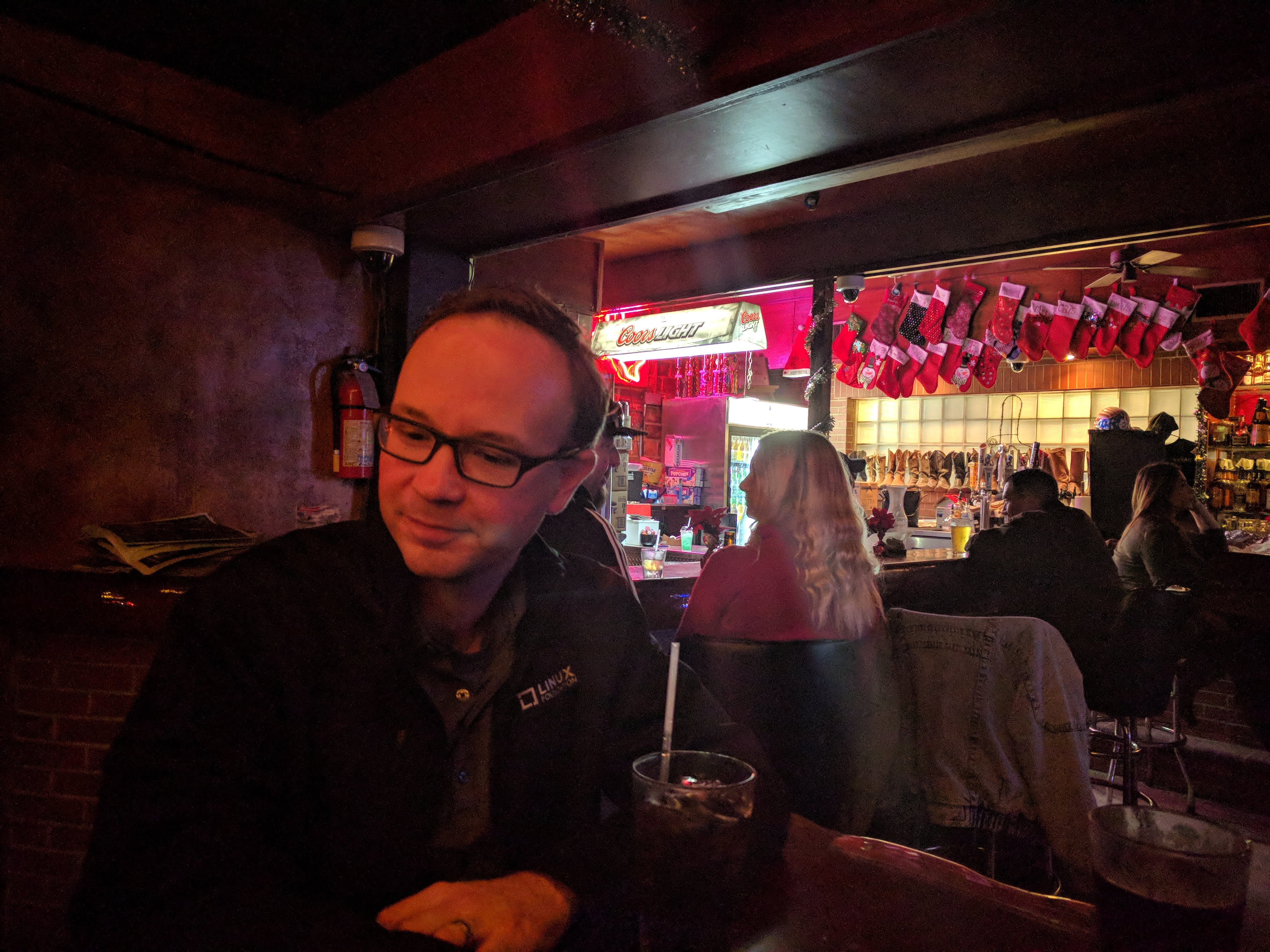
We went to a real Texas dive bar to observe the local customs. I stuck to soda, and after a good Tex-Mex dinner, poured through the weather forecasts for the following day.
Flying from Phoenix to Austin nonstop is not hard in a Skylane, but going the opposite way generally runs into a headwind, lengthening the trip and requiring a fuel stop. Complicating matters was that the weather there in Corpus Christi wasn't expected to improve until late in the morning, but at that point weather all across Texas was to be in good shape the whole day, other than a chance of some small storms in the mountains near El Paso.
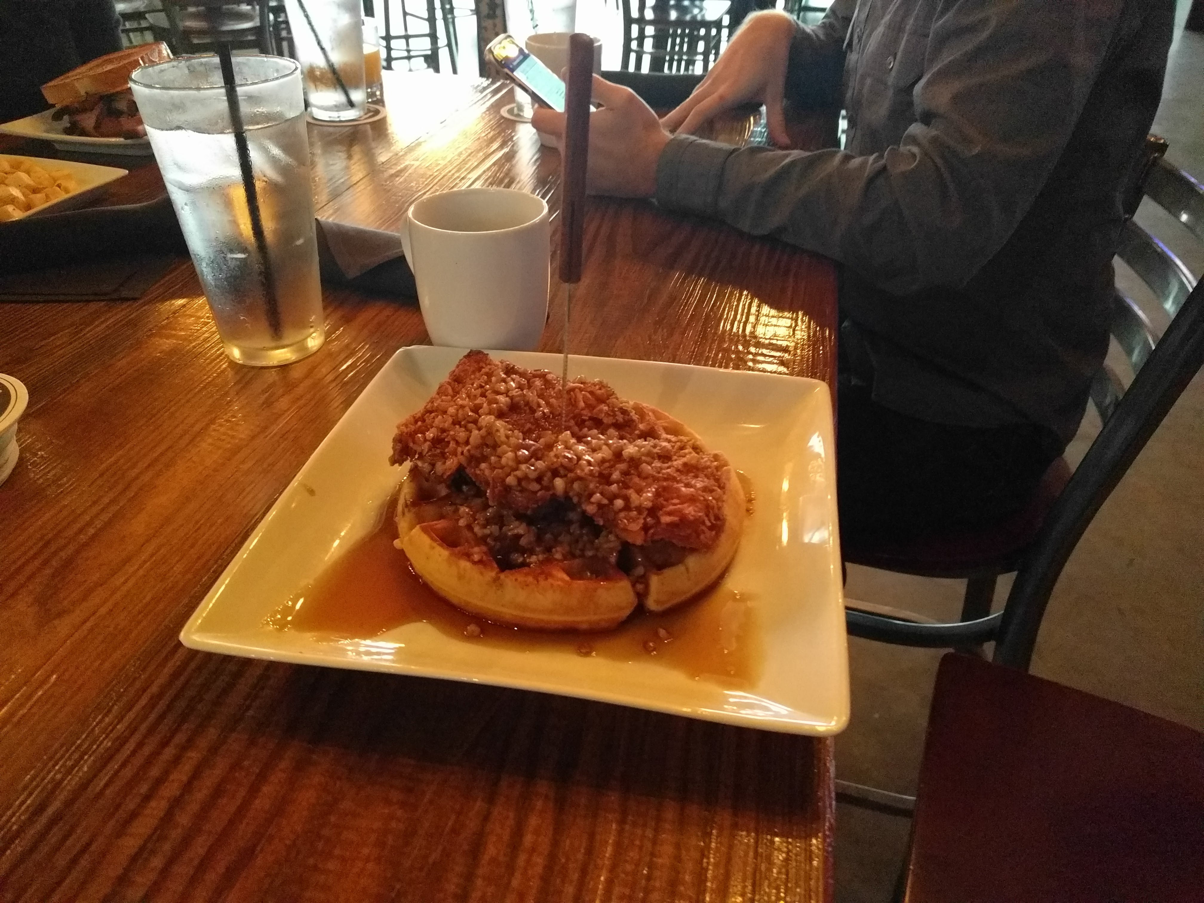
It wasn't difficult to find an excuse for a delayed start that Sunday morning: we went for brunch so that our Chicken and Waffle connoisseur could experience the Corpus Christi version of the height of American cuisine.
I tried not to agonize over our flight path too much during brunch; when we were done eating, I was going to file our flight plan as whatever looked best then.
Shortly before noon we arrived back at Corpus Christi's FBO, which was a busy place that morning. A group of naval aviators were waiting for clearance to depart — a little small-talk as I paid our bill revealed they were the pilots I made go-around the day before. No hard feelings, they said: excuses for extra flight time were always useful. They warned me about the quality of the coffee; apparently a running joke with the FBO staff. (It wasn't that bad.)
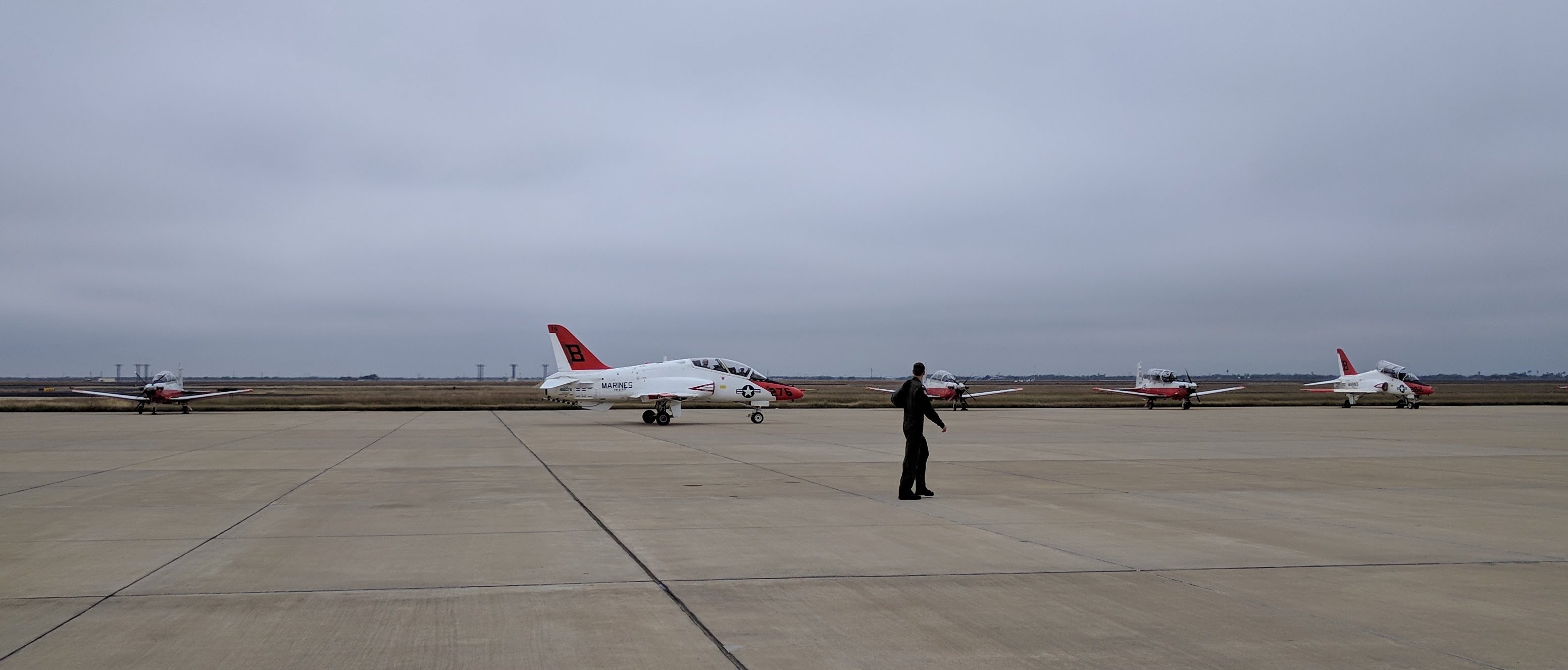
It worked out that the squadron of Goshawks were all departing as we finished pre-flighting and buttoning up our Skylane, so we took the opportunity to watch and wave, and they waggled their ailerons back at us.
The flight plan I filed was from Corpus Christi to Albuquerque, NM, specifically to Double Eagle II Airport a short distance west of town. I had already flown to Double Eagle a few times and knew the area. Our scheduled arrival time was reasonably late in the day at this point, so I called ahead to let the FBO there know we were coming and would need fuel and a rental car. It was going to be late enough in the day we could head into the Old Town and see Albuquerque's holiday luminaria tradition. Also, I just love eating excellent New Mexican food, and planning this way would involve eating in Albuquerque. It's legit.
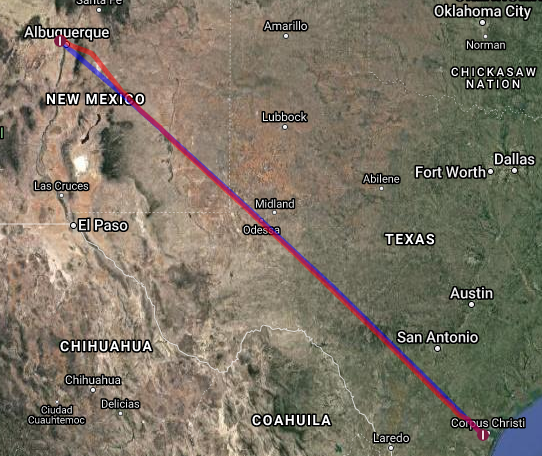
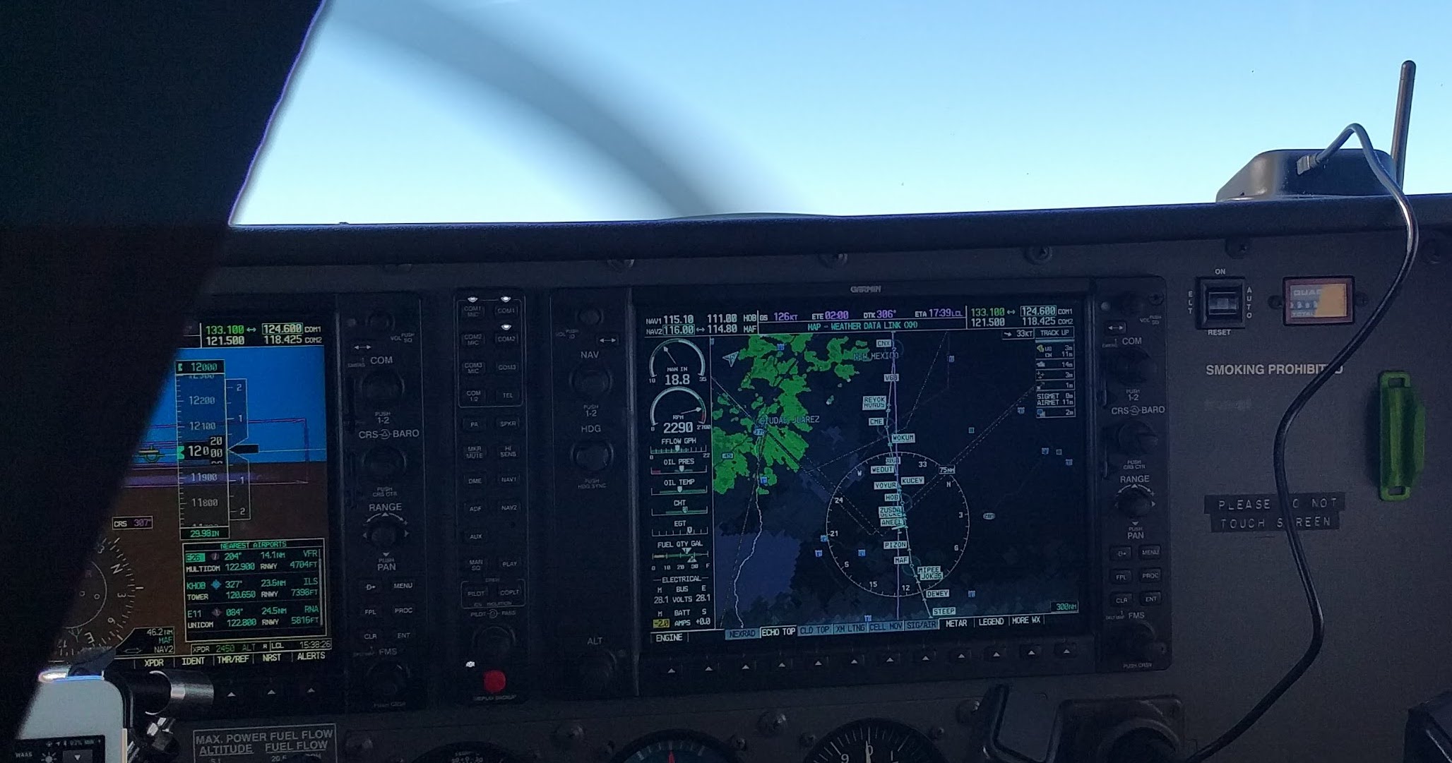
We took off out of Corpus Christi into low clouds but generally good weather on an IFR flight plan. As soon as we were handed to Houston Approach, they cleared us direct to Albuquerque. No joke: a 660 nautical mile direct leg. Check it out:
This was the first flight segment for my two passengers with good conditions, though we were above a cloud layer for the first third of the trip.
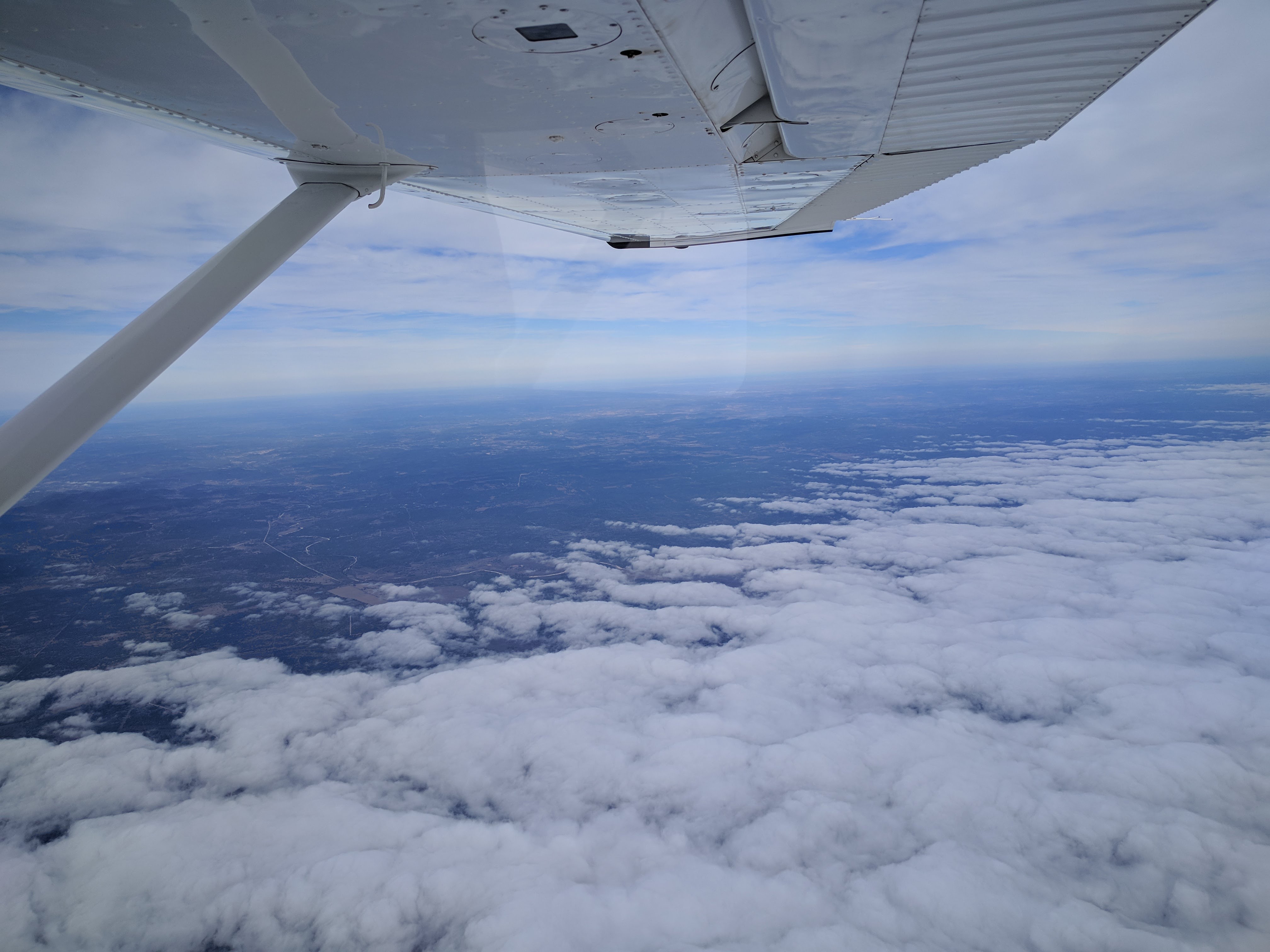
The clouds gave way to the oilfields of west Texas which are always a fascinating sight by air.
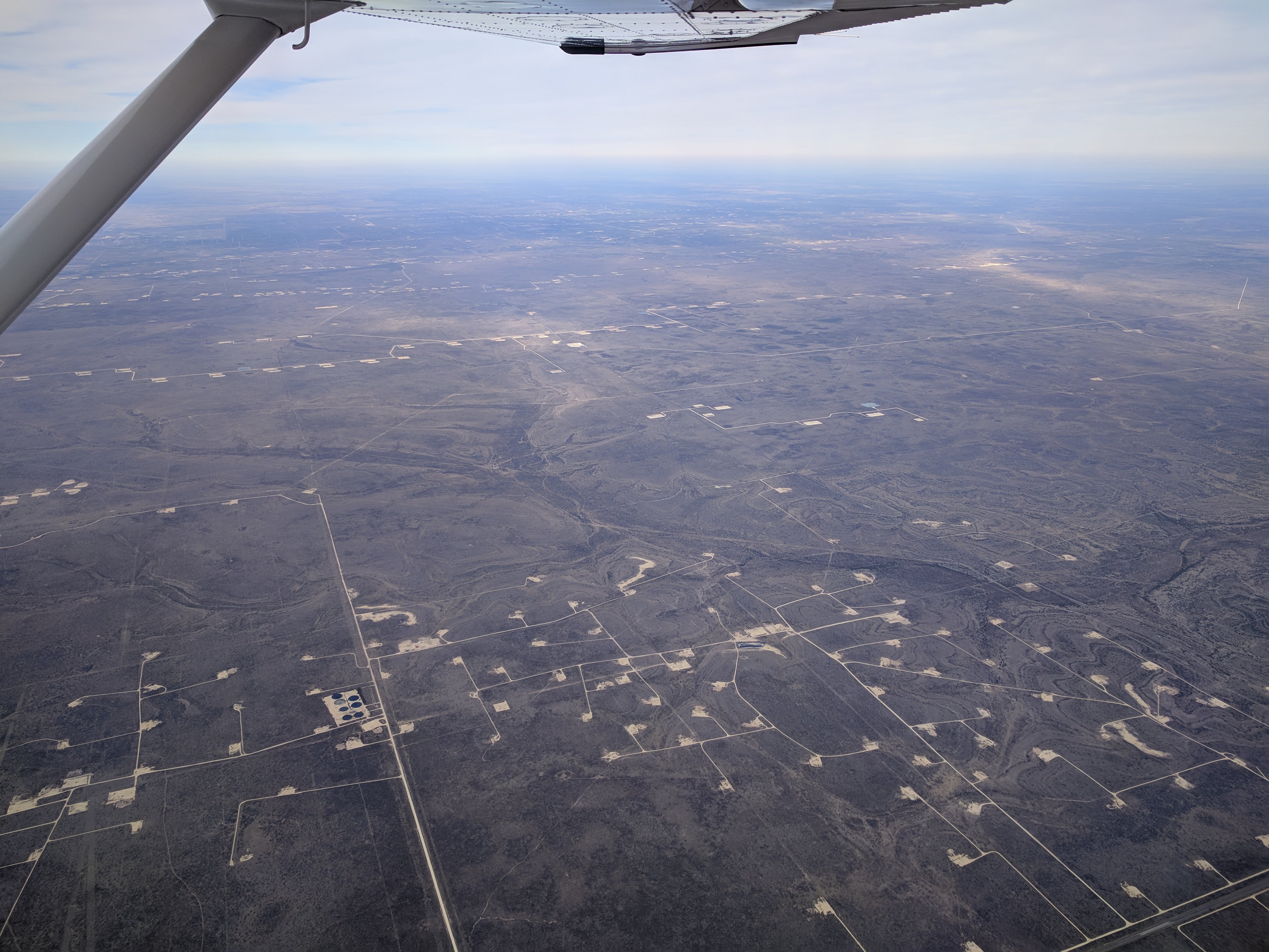
As expected, we fought a significant headwind the whole way to Albuquerque, even at 12,000 feet. The storms that I feared near El Paso absolutely materialized, and covered a larger-than-forecast area, but we only diverted a tiny amount over that long flight, and even that out of an abundance of caution.
The headwind made it long, so when we were handed to a very bored controller at Roswell, New Mexico to transit his airspace, we filed a pilot report rather than listen to the silence.
Approaching the Sandia and Manzano mountains that form the eastern border of Albuquerque, we finally encountered real turbulence. My colleagues bore it well, and we made our way through that natural wind funnel into the city's valley.
We arrived at sundown, and just as always, Double Eagle pulled our rental car right up to the plane for our convenience, and we quickly made our way to the old town.
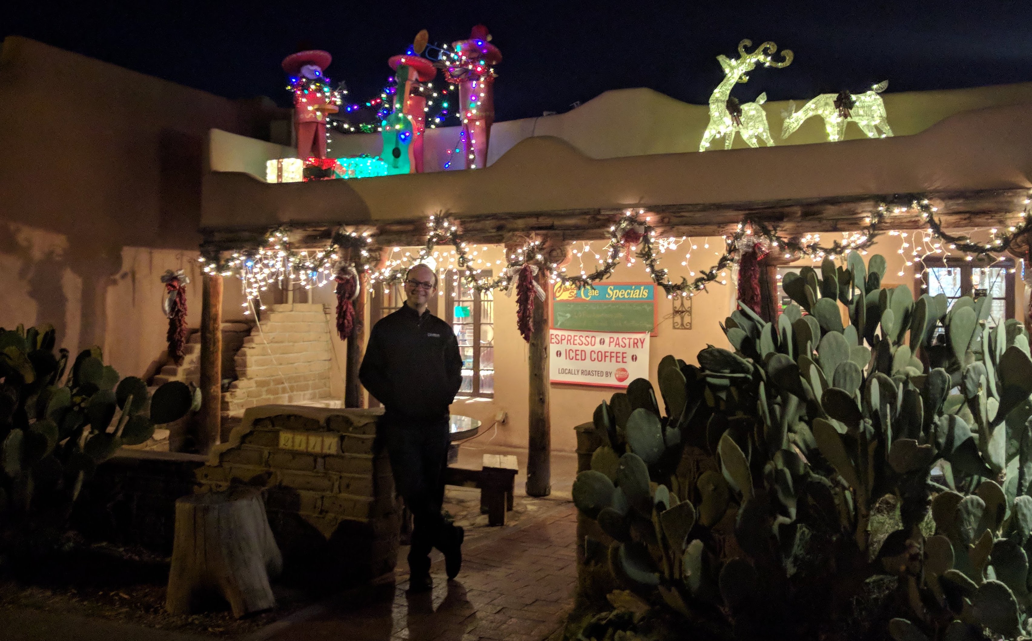
I got my New Mexican food, and we all enjoyed the lit up Old Town area. I suppose it's not a true spectacle like Manhattan or some of the capitals of Europe at Christmas, but there's Western Charm in abundance.
We had a comfortable night downtown and our plane was again fueled and ready to go the rest of the way home when we got to the airport.
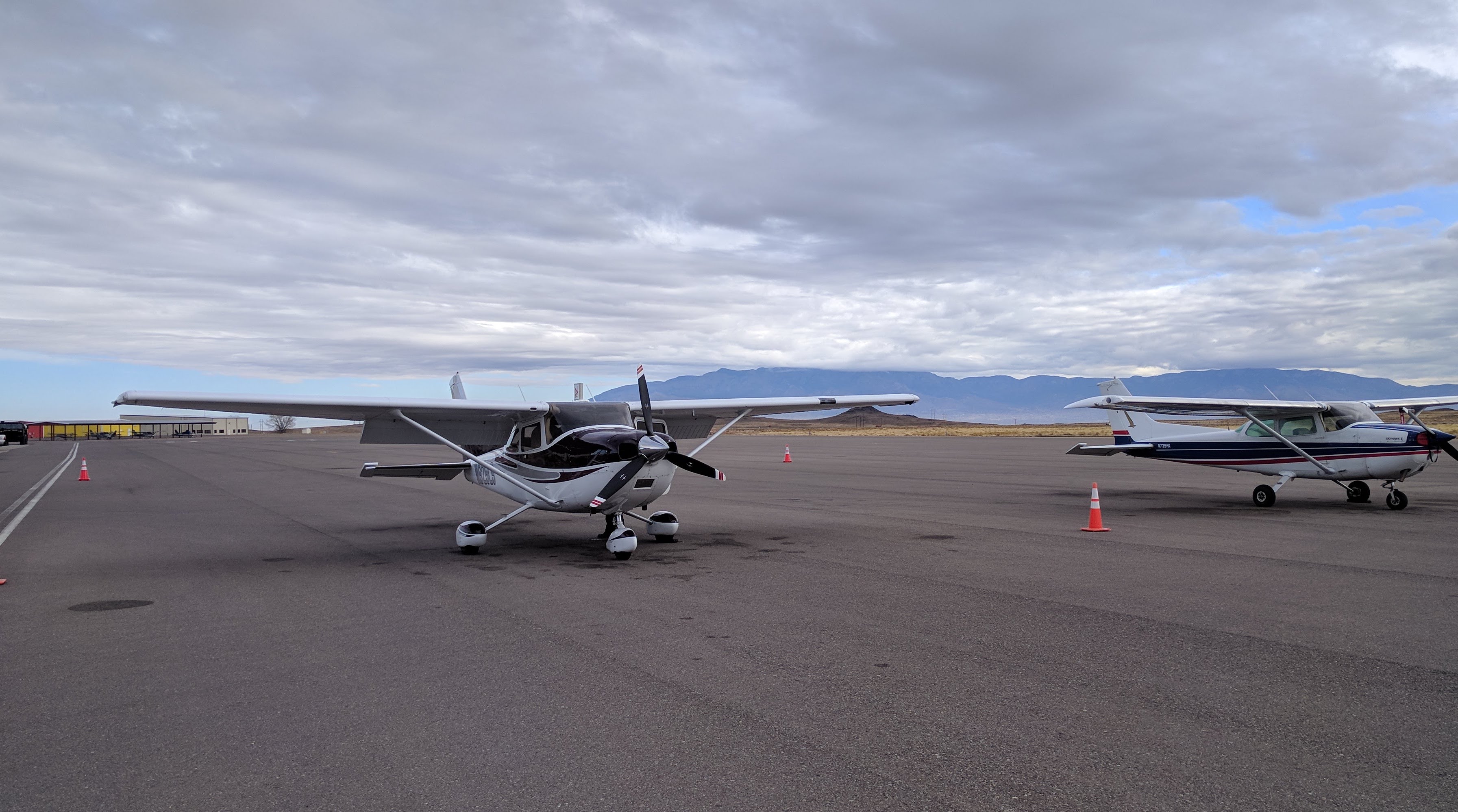
I again filed IFR from Albuquerque back to Chandler, but there was no need for this segment.
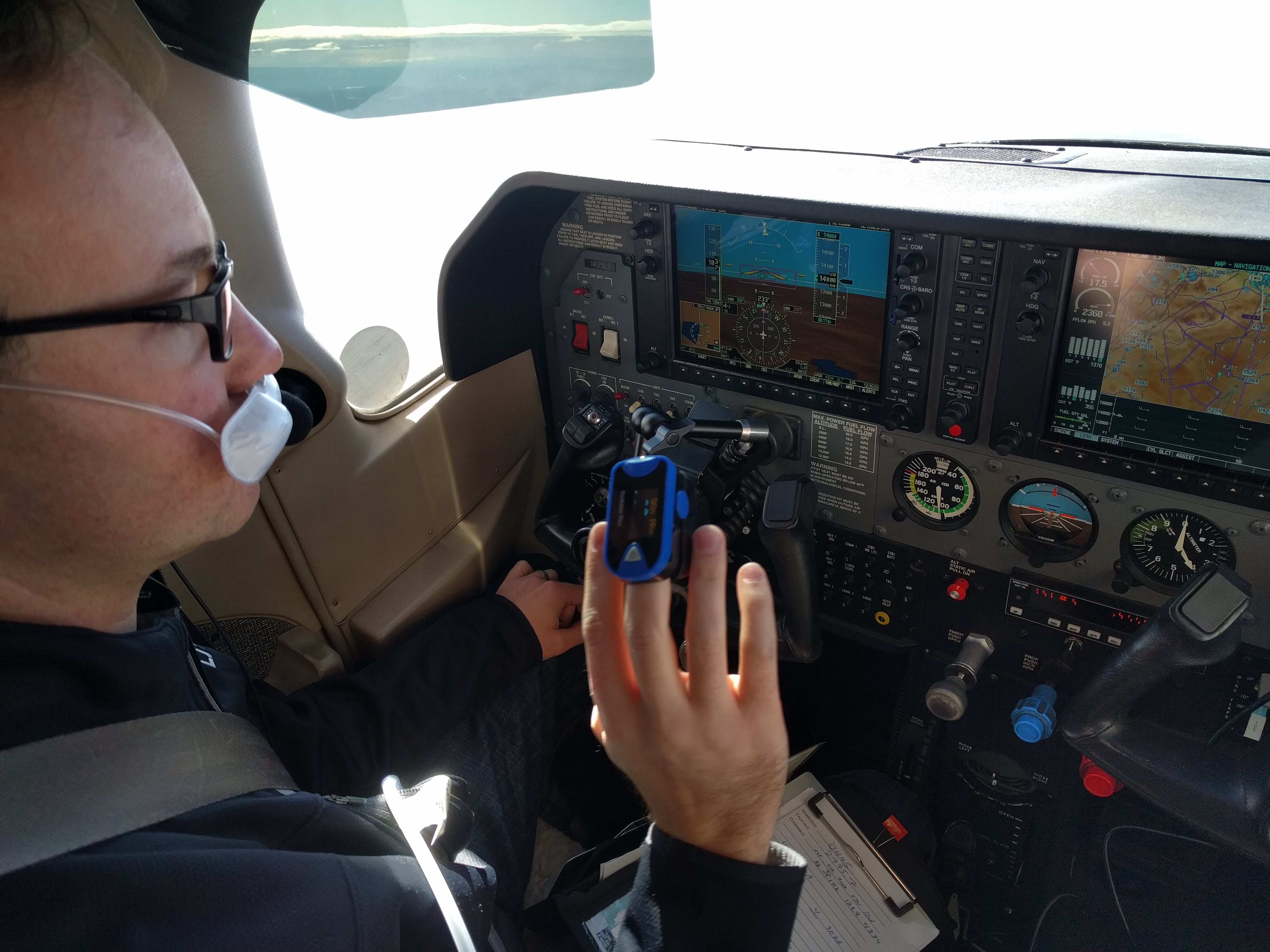
We flew across the Continental Divide and, for better winds, climbed up to 14,000 feet. I'd used my oxygen tank on several occasions for the trip so far, this gave me an opportunity to run the rest of it down — after all, it costs the same to refill a 50% full tank as an empty one, and better winds are a nice bonus.
We actually did fly through a number of small clouds on this leg of the flight, but they were all isolated, seemingly coming out of nowhere to get in our way. Had we been VFR, they would have been easy to dodge. Even IFR, they were small enough to dodge without being off-course, but icing wasn't a concern at those temperatures and, ya know, clouds! Zoom!
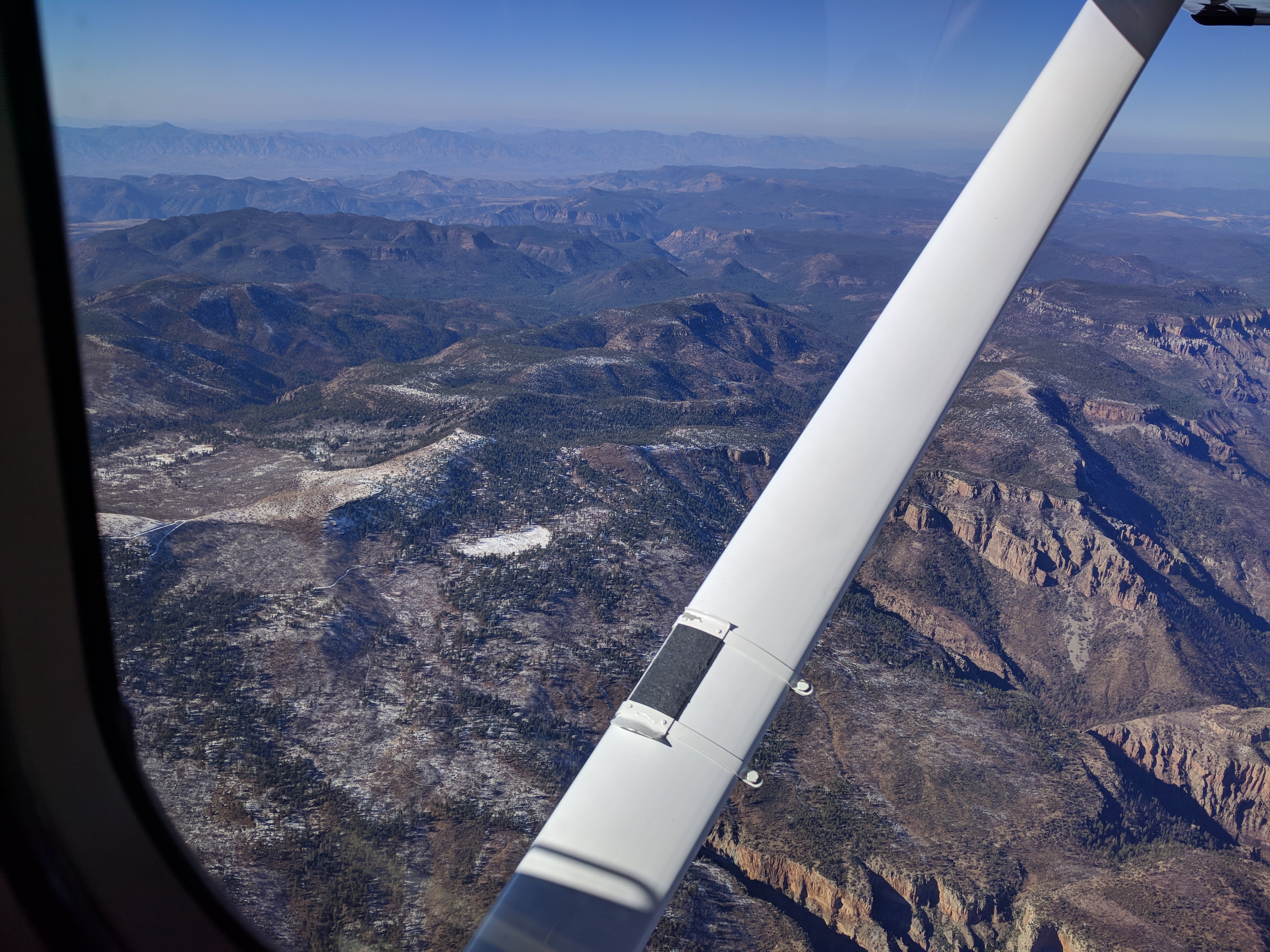
The route from Albuquerque was nice for my colleagues compared to the south route through El Paso since it gave an excellent demonstration that Arizona isn't all low desert and cacti. We flew through the Show Low / Pinetop area with its dramatic snow-capped terrain and temperate valleys.
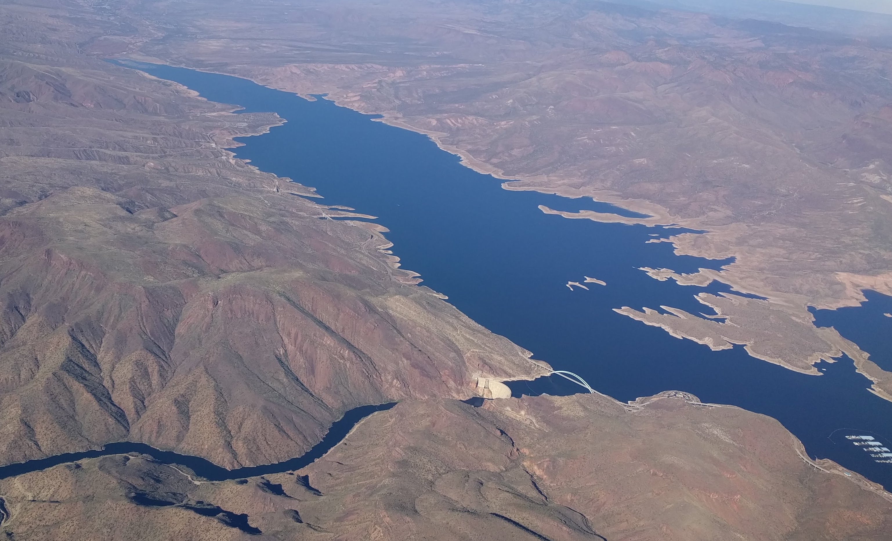
When we were handed to Phoenix Approach, they routed us over Roosevelt Lake, its distinctive bridge, and its dramatic dam
Then it was back home, with the standard approach into Chandler from the East: vectored by Phoenix Approach into the way of Gateway Airport (poor Gateway controllers), then told to contact Chandler Tower and cleared to land.
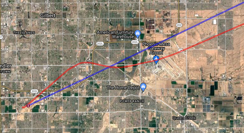
The familiar sight of Chandler's two runways was a good one. I celebrated being back home with my traditional ritual of landing left of the center-line. Oops.
It was good for me to be back home; we flew 1121.3 nautical miles (2077 km) since we had left our fellow Mozillians in Austin, totaling 10 hours in the air. Obviously we added two side-trips to up the number from the 6 hours it took to fly outbound, but it is still simply slower to fight the prevailing winds.
The diversions for weather meant my companions didn't have all that much time back in the Phoenix area with me before their flights back home, but we did make an opportunity for another American delicacy Chicken-and-Waffle at Lo-Lo's Chicken and Waffles and yet more different Mexican food.
This ended up as a perfect trip for reafirrming my personal limits with instrument flying, and with flying in general, and a good opportunity to exercise sound decisions in flight planning. I'm glad we braved the rain and low clouds to go to Corpus Christi, and I'm similarly glad we had a solid alternate plan. I'm glad we did alter our return trip to overnight in Albuquerque, and not just for the food. Above all, I'm glad we made this happen. It really was a Great American Road Trip, but one that just happened to average 200 km/h, and only stopped for souvenirs once.